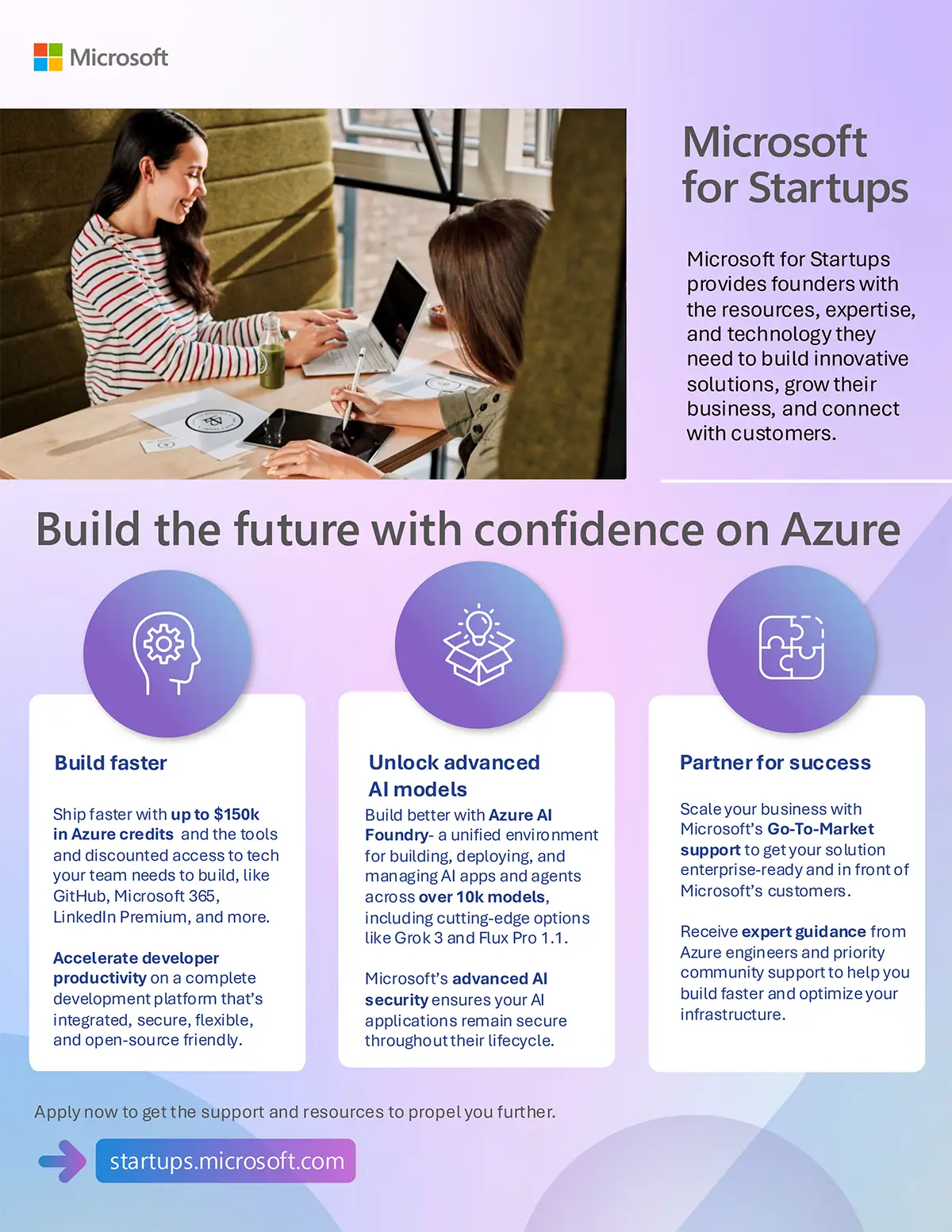
Adostrophe has been accepted into the Microsoft for Startups Founders Hub. This pivotal program provides us with access to a wide range of cloud infrastructure, expert guidance, and development tools that will significantly enhance our capacity for delivering effective digital solutions and accelerate our key initiatives.
Accelerating the Development of Finostrophe
A primary application of the program's resources will be to support the development of Finostrophe, our mobile application designed to make financial literacy accessible to young people in India. Finostrophe aims to address a critical educational gap by teaching practical skills in spending, saving, and investing through an engaging, game-based interface.
The application is being engineered to function effectively in rural and low-internet environments. By using machine learning and a Python backend hosted on Microsoft Azure, Finostrophe will analyze user behavior to provide personalized, data-driven financial guidance. This approach moves beyond generic advice to offer insights relevant to individual habits and local economic contexts.
The Microsoft for Startups program provides the necessary cloud infrastructure, including up to $150,000 in Azure credits, to build, deploy, and manage this data-intensive application at scale, ensuring a reliable and responsive experience for our users.
A Strategic Gateway to a Wider Tech Ecosystem
Our participation in the Microsoft for Startups Founders Hub was instrumental in our acceptance into the NVIDIA Inception Program. This collaboration between Microsoft and NVIDIA provides a powerful launchpad for AI-focused startups, granting us access to NVIDIA's deep technical expertise, market-leading GPU technology, and go-to-market support. This synergy allows us to leverage cutting-edge AI hardware and software, further enhancing the machine learning capabilities at the core of Finostrophe.
Enhancing Productivity and Collaboration with Microsoft 365
Beyond the cloud infrastructure, the Founders Hub provides access to Microsoft 365, empowering our team with a suite of powerful productivity and collaboration tools. Applications like Microsoft Teams, SharePoint, and the Office suite (Word, Excel, PowerPoint) are essential to our daily operations. These tools enable seamless real-time collaboration, secure file sharing, and efficient project management, allowing our lean team to stay connected and productive from anywhere. This integrated ecosystem is vital as we coordinate the complex development of Finostrophe and manage client projects.
Implications for Core Client Services
This partnership also supports the technological foundation of our core services, bringing direct benefits to all our clients:
- Web Development with Azure Static Web Apps (SWA): For our web development projects, we are leveraging Azure Static Web Apps. SWA offers a streamlined workflow with first-class GitHub integration, where repository changes automatically trigger builds and deployments. This allows for rapid iteration and the use of preview environments to test changes before they go live. The globally distributed content delivery network ensures our clients' websites are fast and responsive for users worldwide.
- Matterport Solutions: Cloud resources enable the development of custom Matterport integrations, such as dynamic audio descriptions for accessibility, and enhance the optimization of spatial data.
- Google Ads & Ad Grants Management: The resilient and scalable Azure infrastructure improves our capacity to manage and analyze data from large-scale advertising campaigns.
Our Commitment to Innovation
Joining the Microsoft for Startups Founders Hub is a significant milestone for Adostrophe. It aligns perfectly with our commitment to using robust, scalable technology to solve practical business problems for our clients while advancing our mission to promote financial literacy through Finostrophe. This partnership enhances our ability to deliver high-quality, innovative digital solutions and solidifies our foundation for future growth.
Technology-Driven Solutions for Business
Learn how Adostrophe's enhanced technical capabilities can be applied to your project.
Schedule a ConsultationProgram & Technology FAQs
What is Microsoft for Startups Founders Hub?
It is a program by Microsoft that provides startups with free access to Azure cloud credits, developer tools like GitHub Enterprise, Microsoft 365 for productivity, and expert technical guidance and mentorship to help them build and scale their business on Microsoft's platforms.
What is Finostrophe?
Finostrophe is a mobile application in development by Adostrophe. It uses machine learning and a game-based interface to teach essential financial literacy concepts to underserved populations, particularly youth in India.
How does this partnership benefit Adostrophe's clients?
Access to Microsoft's cloud infrastructure and development tools allows us to build more scalable, secure, and high-performance digital solutions. This translates into more innovative Matterport applications, faster and more reliable websites built on technologies like Azure Static Web Apps, and more efficient management of large-scale ad campaigns for our clients.