Industry · AEC & construction
As-built documentation for offices and interiors.
3D capture gives architects and facilities teams an accurate as-built record of a completed interior, without redrawing it from scratch.
From the capture-program era, the standard here: progress states dated, as-builts aligned to prior captures.
A few of the spaces
Real projects, real locations.

A real tour
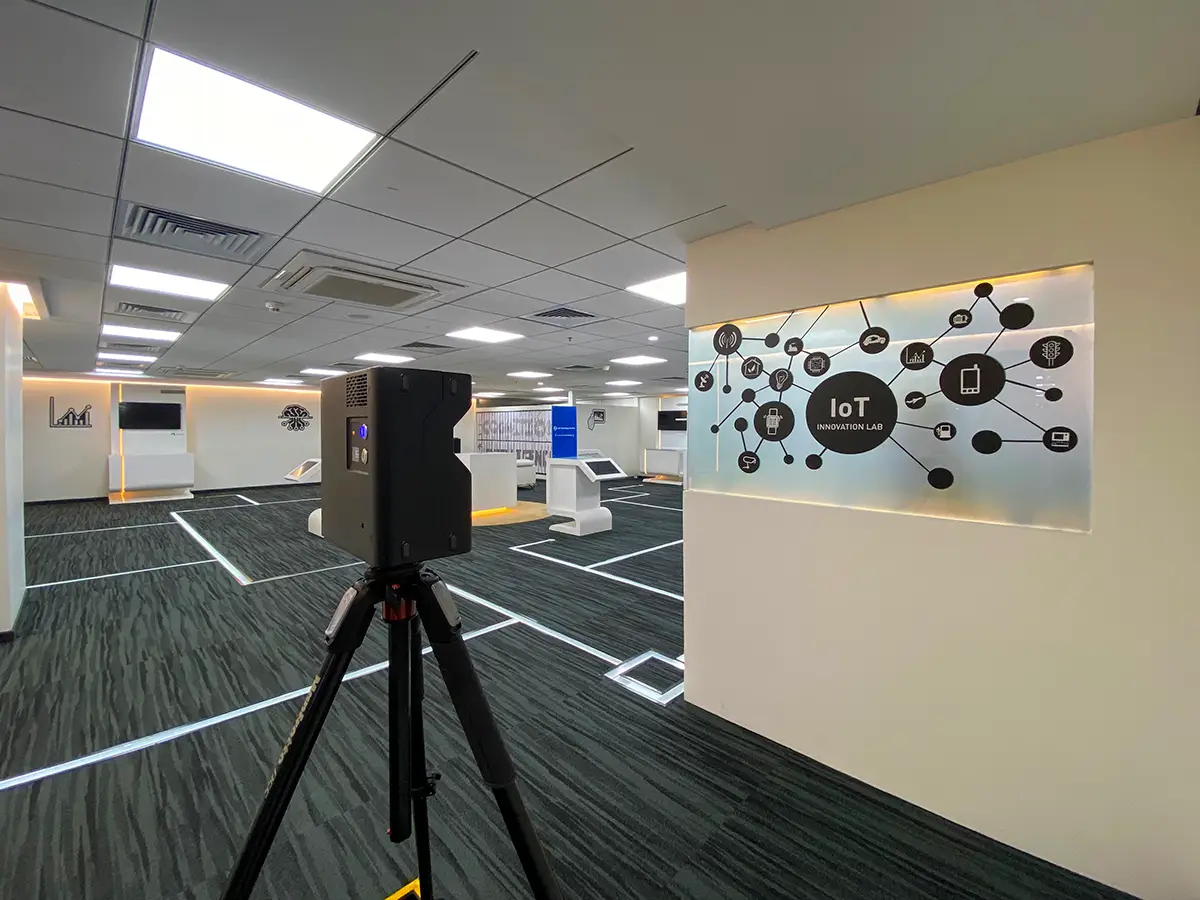
Dassault Systemes, Pune.
Click to explore this space
This project's raw E57 point cloud is available as a direct download: dassault-pune-e57.zip (~99MB).
Hardware specifically
Where Matterport fits, and where it doesn't.
Matterport's real strength is high-resolution imagery combined with a fast, vendor-neutral E57 export, particularly useful for as-built records, walkthrough context, and getting a usable point cloud quickly. For dense, survey-grade point clouds specifically, the actual industry standard is different hardware entirely: Faro Focus, Leica's total stations, Trimble. Among people who work in point clouds professionally, even a Matterport Pro3 or a Leica BLK360 is considered a toy next to that equipment. Worth saying plainly rather than overselling what a Matterport scan is.
Where a project actually needs Faro Focus-grade density, that can be organized directly, alongside a Matterport tour or as a standalone scan. The Dassault Systemes project above is a real example: a conference room and a water treatment plant were documented in parallel, this work on Matterport and a separate agency running a Faro Focus scan on the same site. Get in touch if a project needs that level of density.
A pattern worth naming
Why architects specifically tend to value this.
Across industries, architects are consistently the easiest clients to work with on this. They intuitively get what a Mattertag, a measured floor plan, or a genuine walkthrough is actually useful for, in a way that doesn't always need explaining. Both Priya Living properties (Gurugram and Hyderabad) were contracted through the architects on those projects, not directly by the developer. That's not a coincidence worth ignoring.
Worth knowing.
Dassault Systemes, Pune: a conference room and a water treatment plant, documented for as-built records, captured alongside a separate agency's Faro Focus scan of the same site.
L&T, Manyata Tech Park, Bangalore: office interior documentation.
JW Marriott, Prestige Golfshire: mid-construction site-status capture, on the route to Nandi Hills, a popular weekend escape from Bangalore's traffic, and home to a golf course used by professional and Karnataka Golf Federation members alike.
Automated dimensions
Property Reports: what actually gets measured.
A processed Matterport space can generate an automated Property Report: net floor area, gross floor area, and ceiling height, broken down room by room, exportable as a CSV. This runs off room-layout detection during processing; a space with unusual geometry or an incomplete layout won't generate one automatically, and needs walls added manually through Matterport's Property Layout tool first. Worth knowing before assuming every scan comes with this data attached. It depends on how cleanly the space maps to a detectable layout, not a given on every project.
Available add-ons
File formats an AEC team actually works in.
A finished scan can go further than the tour itself, through Matterport's own platform add-ons, available on request, not something automatically included. A 2D CAD file and a 3D BIM model in Revit can both be generated from a Matterport space, practically usable across design, construction, and facilities management. A MatterPak bundles the underlying 3D data (OBJ, XYZ point cloud, floor plans) into one set for a design team to build from directly. The E57 point cloud export already covered above is part of the same family.
To be direct about scope: these are existing Matterport platform capabilities, not something delivered as standard on every project here. Get in touch if a project needs one of these specifically.
Related
Where this connects.
Matterport's own research on this industry is worth a look too: matterport.com/industries.
Before you ask
AEC & construction, specifically.
Can this replace a full BIM survey?
Not on its own. It's a fast, accurate visual and dimensional record of a completed space, useful alongside BIM rather than instead of it for complex builds.
Other industries
The rest of the list.
Start a project
Tell us about the space, and we'll tell you what it'll take.
Most replies come within a day. Most enquiries start with a short email about the space.
Email info@adostrophe.com