Journal · Guide
Not all virtual tours are the same.
Published July 2, 2025 · Updated July 19, 2026
"Virtual tour" covers a much wider range of actual technology than the phrase suggests, from a smartphone panorama with no real geometry behind it, all the way to a dimensionally accurate 3D model. The real differences matter before assuming they're interchangeable.
Six real methods, in order of what they actually capture
Smartphone capture: zero hardware cost, using the phone's own panoramic stitching. Reasonably useful for a quick, informal record; no real dimensional accuracy and often visibly distorted.
DSLR panorama: a proper camera with a fisheye lens on a calibrated panoramic head, stitched with dedicated software. Excellent visual quality, still no underlying geometry: it looks real but can't be measured.
Dedicated 360° cameras (Ricoh Theta, Insta360, and similar): faster to shoot than a DSLR rig, quite good for point-to-point navigation between panoramas, but the same limitation applies. No real depth data sits behind the image.
Drone capture: useful for large exteriors and site context impossible to get from the ground, generally used as an introductory overview alongside other capture, not the main asset on its own.
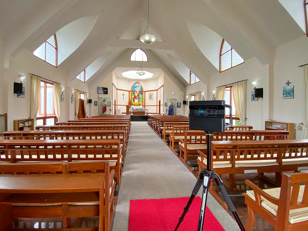
Professional 3D scanning (Matterport Pro2, and similar hardware): the only method on this list that combines real visual fidelity with genuine depth data, sub-inch dimensional accuracy, a real measurable model rather than just a navigable image. This is what every project on this site is actually built on.
Bespoke VR simulation: a fully different category. Computer-generated environments built in engines like Unreal or Unity, used when a physical space doesn't exist yet (pre-construction visualization) or for interactive training simulations. Not a capture method at all, and not something offered here.
Choosing the right one
The real question is simple: does this need to just look right, or does it need to be measurable? A retail listing or a quick internal record can reasonably use a phone or a 360° camera. Anything where a buyer, an architect, or a facilities team needs to rely on an actual dimension, like a manufacturing plant, a museum, or a hotel ballroom being booked sight-unseen, needs the real depth data that only professional 3D scanning provides.
Before you ask
Worth knowing.
What's the actual difference between a 360° photo tour and a Matterport scan?
A 360° photo tour is a navigable image with no real geometry behind it. It looks right but can't be measured. A Matterport scan combines visual capture with genuine depth data, producing a dimensionally accurate model that supports real measurement.
Is drone footage part of a standard project here?
It's mentioned as a legitimate method for large exteriors generally, but it's not part of the standard capture offered here. Every project on this site is built on professional 3D scanning.
When would bespoke VR simulation make sense instead of a real scan?
When the physical space doesn't exist yet (pre-construction visualization) or for interactive training simulations. It's a fundamentally different category from capturing a real, existing space.
Start a project
Tell us about the space, and we'll tell you what it'll take.
Most replies come within a day. Most enquiries start with a short email about the space.
Email info@adostrophe.com